I've been wanting to summit the Agua Caliente Hill trail for quite some time, ever since we moved to NE Tucson about 4 years ago. For those that aren't familiar with the hill, it is the hill between the Catalina and Rincon mountains. The trailhead is exactly 2 miles from my house, and I often run the first mile or so of the trail in the middle of my usual running route. The summit is 4.5 miles from the trailhead, and I had been as far as 3.5 miles into the trail. Previous attempts to summit failed due to others in my traveling party. My brother petered out around mile 3.5, and on a later trip Zac gave up on me, claiming blisters at mile 3. So, to summit I would have to do it on my own.
Currently, the TTG December Runathon is going on. I have always wanted to summit this trail as part of the Runathon, and this year I decided to do it. Previous years I didn't plan as well. Last year I didn't run much before December and the increased mileage of December caused some pain in my heel. This year I came into the Runathon with a good base of running behind me. The weather was supposed to move in on Sunday, so I chose Saturday, December 17th as my day to run the trail.
The trail alone is 9 miles. I could drive the 2 miles to the trailhead, or leave from my front door to make it 13 miles and a half marathon. Front door it is! I loaded up my hydration pack with water and snacks, tied a windbreaker to it, stashed the cell phone and camera in the pack, ate 4 of Leslie's snickerdoodle cookies as my last meal, and wrote on the fridge whiteboard "Left for ACH at 12:20 PM" as a note to Zac. With that I walked out my front door and started my Garmin.
(All photos can be clicked on to enlarge).

Thankfully, my house is round and with a reflective copper roof it is easy to find from various points on the trail. As I trotted up Ft. Lowell at an easy pace, I took this picture of the mountain, my destination for the entire day.

I kept the first 2 miles on the road nice and easy. There were a few cars in the parking lot of the trailhead as I ran up to the gate. I looked at my Garmin: 2.1 miles at the gate. With that I started the trail. The trail starts out easy for only a few yards, then immediately begins to climb. One has to step over several water bars in the first mile because of the grade. This is my least favorite section of water bars. They are so tall that I have to really step high to get over them.

This is the view from only a quarter mile into the trail. My house is down there somewhere. The horses can't step up the steep water bar section, hence the marker for a side trail which I call "Pony Bypass", which is a short section of a single switchback.

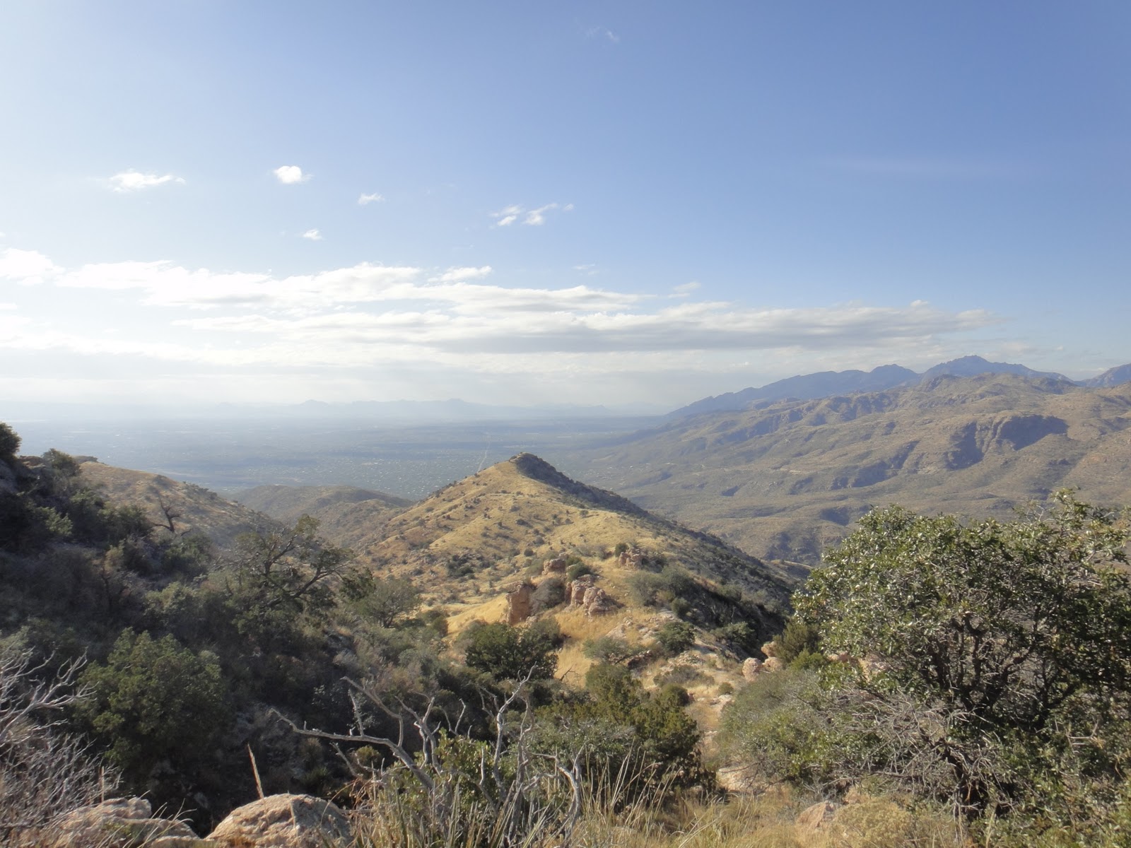
About a mile into the run and a view of the mountains ahead I have yet to climb.

Self shot, proof that I'm out there running.

Looking out over Tucson, about 1.5 miles into the trail.

Agua Caliente hill is known as one of Tucson's best false summits. Everyone thinks that the summit is the grassy knob that appears as the highest point to the left. It's not. The true summit lies behind it, about another mile.

About 2 miles in I reached the pond, "Cat Track Tank." The pond has been bone dry the last few times I've run to this point, so it was nice to see some water. A few springs ago it was nice and full and the ducks had moved in, so hopefully with all of this rain the pond will fill again and the ducks will return. You can see the trail skirts along the right side and leads up to the saddle in the distance.

As I climbed the saddle, the sun came out. Tons of saguaros in this area.

A hawk was circling overhead, landing on the saguaros.

Once you reach the saddle, it's the first point at which you can look over onto the Catalina side. This is where FR #4445 intersects the trail.

At this point, the summit is still 1.5 miles away. Most start the climb here and think it's the grassy knob, but the summit is the section of dark trees behind it.

This is at the top of the grassy knob, and the section of trail that skirts alongside of it. Nice, easy running here.

Proof that I'm still running at this point. Snow on the Catalinas behind me.

And here's the view on the climb up the summit, looking back at the grassy knob.
I've wandered the trails on this side of the Catalinas.

Finally I reached the summit! 6.62 miles from home, 2 hours and 10 minutes, and 3000 ft total climbed to get to the top at 5300 ft.

Here's the 360 degree view from the top. The Catalinas, where you can see the road winding up.

East side of the Catalinas.


Snow on the Rincon Mountains.

Rincon Mountains and Saguaro National Park. Redington Rd is the ribbon of dirt road down below.

Saguaro National Park and back to Tucson.

At the summit there is a geodetic marker, which I had to take a picture of with my foot.


Proof that I was at the top.

Buried in a pile of rocks is a mason jar with several small notebooks and pencils inside. People that reach the top write notes to mark they were there. With all of the technology of today it's still fun to follow low-tech documentation techniques in remote areas. However, I included today's technology by texting a few people from the summit, and updating my facebook status. I figure the time stamp helps search parties reduce the radius in which to search.

I found the latest entry and wrote mine. No inspiring words. I pretty much stated the obvious.

One last final view of Tucson down below before heading back down. I could still see my house from here, a bright little triangle.

As I headed down the trail, the clouds of the impeding storm front started moving in, causing rays of sunlight to cast down on Tucson like a theatrical spotlight show.

Up on the grassy knob as I headed down, the contrast was such that it was easy to see the sections of singletrack trail through the hills that led back home.

Act 2 of the spotlight show.

This photo is significant for a few reasons. 1) I was exactly 4 miles from home and at this point ran out of water. 2) This section of trail is rocky, causing one to look down a lot. I glanced up at at this moment right in front of me I found my house. It was perfectly in view in line with the trail. Straight ahead there is a dead saguaro with a curvy arm. Below the curvy arm and just to the right of the straight saguaro is a faint triangle. That's my house! So at this point I wasn't too worried about being out of water.

Looking back at the grassy knob and trail I had traveled as the sun cascaded over the hills. I was now part of the spotlight show.

What a typical rocky climb on the trail looks like. Hence the long travel time.

About a mile from the trailhead the sun started to set. I was racing the sun home.

Lower in elevation, one last look at the sunset before I headed down to the pavement below.

In the last half mile of trail I passed several trail users coming up the trail, obviously out for shorter jaunts. It was nice knowing I had finally covered the entire trail and been to the very top. I hit pavement and enjoyed the last 2 miles home, grateful for flat pavement and easy footing. I walked in the front door at 5:30 PM, just as the sun had almost set. 13.24 miles, 4 hours and 7 minutes of running, 3000 ft of climbing, all from my front door.

2 comments:
Nice work, Elaine! Thanks for all the photos :)
“Congratulations Wrenchette! Thank you so much for taking the time to share this exciting information.”
triathlon
Post a Comment